Farming in the valley
Farming in Borrowdale dates back to at least a thousand years, when Scandinavians settled the valley as refugees from Ireland. This mountainous environment was likely familiar to them, and they cleared the land, called 'thwaites', to form settlements and set up summer pastures, 'saetres', for their livestock. Many of the hamlets in Borrowdale have the suffix 'thwaite', hinting at a long history of inhabitation.
Archaeological remains at Thorneythwaite near the head of the valley were recently identified as Iron Age, providing further evidence of the area's rich past.

The Abbey Factor
The Norman Conquest led to the creation of numerous baronies in the north of England, with Borrowdale being part of them.
In 1209, Alice de Rumelli sold a portion of her land, including the Manor of Borrowdale, to Furness Abbey. Monks from Fountains Abbey in Yorkshire also owned and managed land in the area.
Historical Abbey records mention Herdwick sheep, the true native breed of the Lake District, and Herdwick wool was used to make the monks' habits.
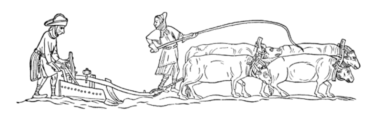
For almost 350 years, the monks farmed the valley, not only for wool, but also for rye, oats, and barley.

Medieval practices and beyond
During the medieval period, Borrowdale's inhabitants would have been much more self-sufficient than today.
The region's land was largely arable, with crops grown to sustain the locals and livestock raised for food.
Evidence of the "ridge and furrow" created by ox-drawn ploughs can still be seen in the area, most visible in low sunlight or when snow-covered.
Around Rosthwaite, the 'ridge and furrow' is particularly noticeable.